BC’s active transportation design focuses on safe, connected networks for walking and cycling, utilizing guidelines for infrastructure.
Historically, “BC” denoted time Before Christ, but now signifies British Columbia’s commitment to modern, accessible routes.
Overview of Active Transportation
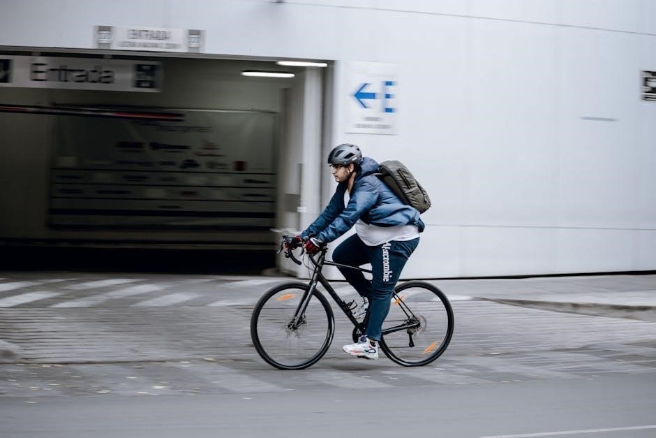
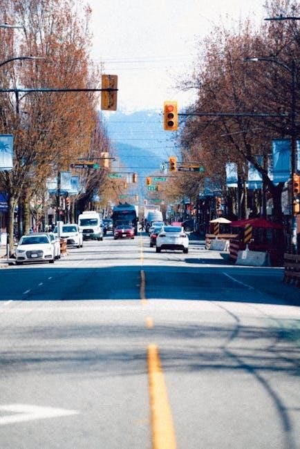
Active transportation, encompassing walking, cycling, and other human-powered modes, is central to British Columbia’s vision for sustainable communities. This approach prioritizes people, fostering healthier lifestyles and reducing reliance on automobiles. BC’s design guide emphasizes creating networks that are safe, convenient, and appealing for all ages and abilities.
Historically, the term “BC” signified “Before Christ,” but within this context, it represents a bold commitment to a future where active modes are seamlessly integrated into daily life. This includes prioritizing connectivity, accessibility, and the thoughtful consideration of diverse user needs. The goal is to build a province where choosing to walk or cycle is the easy and preferred option for many trips.
Importance of Design Guidelines
Design guidelines are paramount in British Columbia’s active transportation initiatives, ensuring consistency and safety across all projects. These guidelines move beyond simply adding bike lanes or sidewalks; they focus on creating holistic systems that prioritize user experience and address potential conflicts. Historically, a lack of standardized approaches led to fragmented networks and safety concerns.
BC’s guide provides a framework for planners and engineers, promoting best practices in areas like intersection design, pavement markings, and accessibility. Adhering to these standards minimizes risks, encourages wider participation, and ultimately contributes to a more livable and sustainable province. Consistent application of these principles is vital for building a truly connected and inclusive active transportation network.
Planning and Network Development
BC’s planning prioritizes linking key destinations with safe, integrated routes for all users, fostering a connected network for active travel.
Identifying Key Destinations
Successfully planning active transportation networks in British Columbia necessitates a thorough understanding of crucial destinations. These aren’t limited to traditional hubs like workplaces and schools, but extend to community facilities – libraries, recreation centers, and healthcare providers. Retail areas and transit connections are also paramount.
Effective identification involves analyzing population density, existing pedestrian and cycling patterns, and potential demand. Consideration must be given to accessibility for all ages and abilities. Prioritizing destinations that serve a broad range of needs ensures maximum network utilization and encourages a shift towards sustainable transportation choices. Data-driven decision-making, incorporating public input, is essential for pinpointing these vital locations.
Connectivity and Network Integration
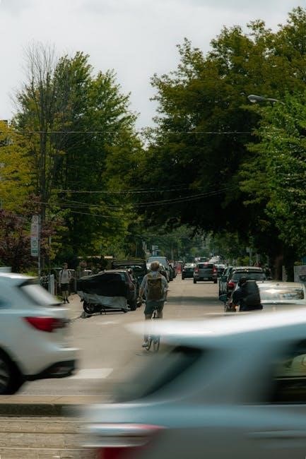
A truly effective active transportation system in British Columbia isn’t simply a collection of isolated paths; it’s a seamlessly integrated network. Connectivity demands linking key destinations – identified previously – with safe, direct routes. This includes bridging gaps in existing infrastructure and prioritizing connections to transit hubs.
Network integration requires considering all modes of transportation. Bicycle routes should complement pedestrian walkways, and both must interface smoothly with public transit. Addressing barriers like major roadways or natural features is crucial. Prioritizing continuous, low-stress routes fosters increased ridership and encourages active travel for everyday journeys, ultimately enhancing community livability;
Prioritizing Routes for Active Transportation
Effective prioritization of active transportation routes within British Columbia demands a data-driven approach. Routes serving schools, healthcare facilities, commercial centers, and transit hubs should receive initial focus. Consideration must be given to existing pedestrian and cyclist volumes, identifying areas with high demand and potential for growth.
Equity is paramount; prioritizing routes in underserved communities can address transportation disparities. Safety audits should pinpoint high-crash locations needing immediate improvements. Furthermore, routes connecting to regional trails and greenways enhance recreational opportunities; A phased implementation plan, based on cost-benefit analysis and community input, ensures efficient resource allocation and maximizes impact.
Design Considerations for Bicycle Facilities
Bicycle facility design in BC necessitates careful attention to lane width, pavement markings, and the strategic choice between lanes and protected cycle tracks.
Lane Width and Pavement Markings
Establishing appropriate lane widths is crucial for bicycle safety and comfort within BC’s active transportation networks. Guidelines typically recommend a minimum of 1.2 meters for bicycle lanes, though wider lanes – up to 1.5 meters – are preferable where feasible, particularly on higher-speed roadways.
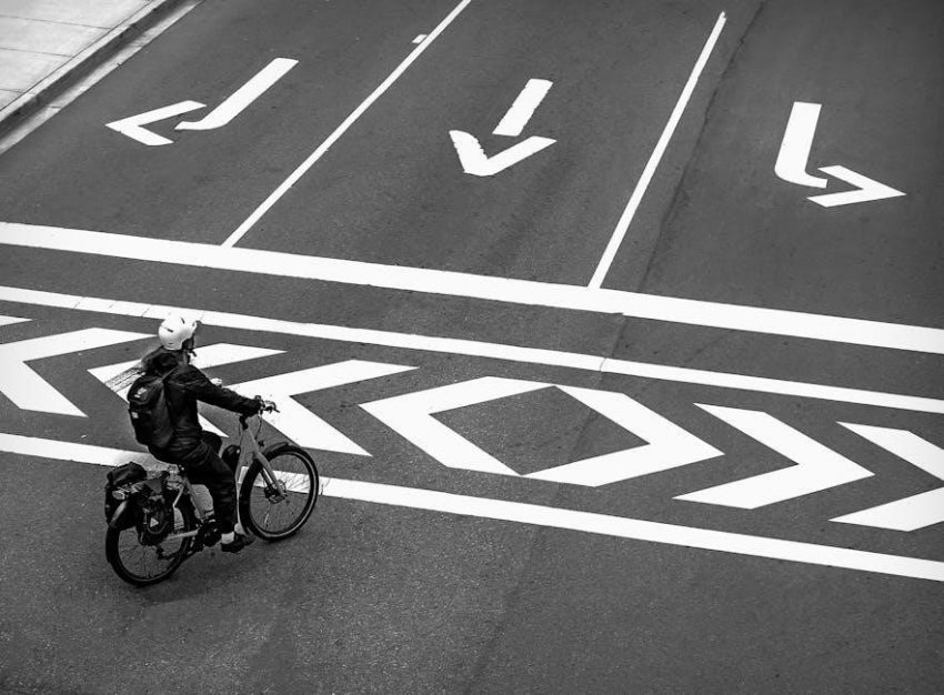
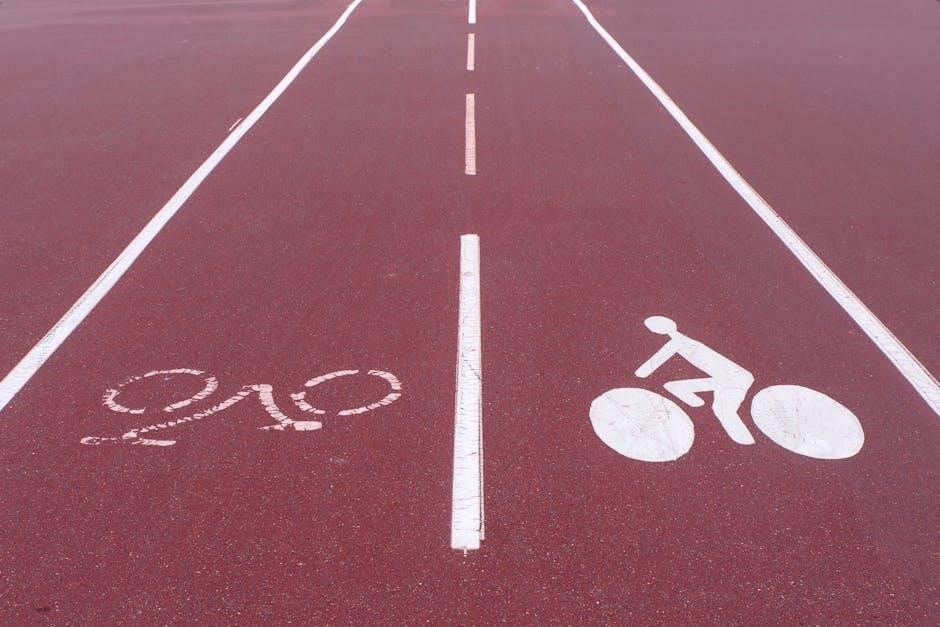
Pavement markings play a vital role in defining bicycle space and alerting motorists. Solid white lines delineate bicycle lanes, while sharrows (shared lane markings) indicate routes where cyclists and vehicles must coexist.
Strategic use of colour – such as green pavement markings at conflict points like intersections – enhances visibility and further clarifies bicycle pathways. Consistent and clear markings are essential for promoting safe cycling behaviour and reducing potential collisions.
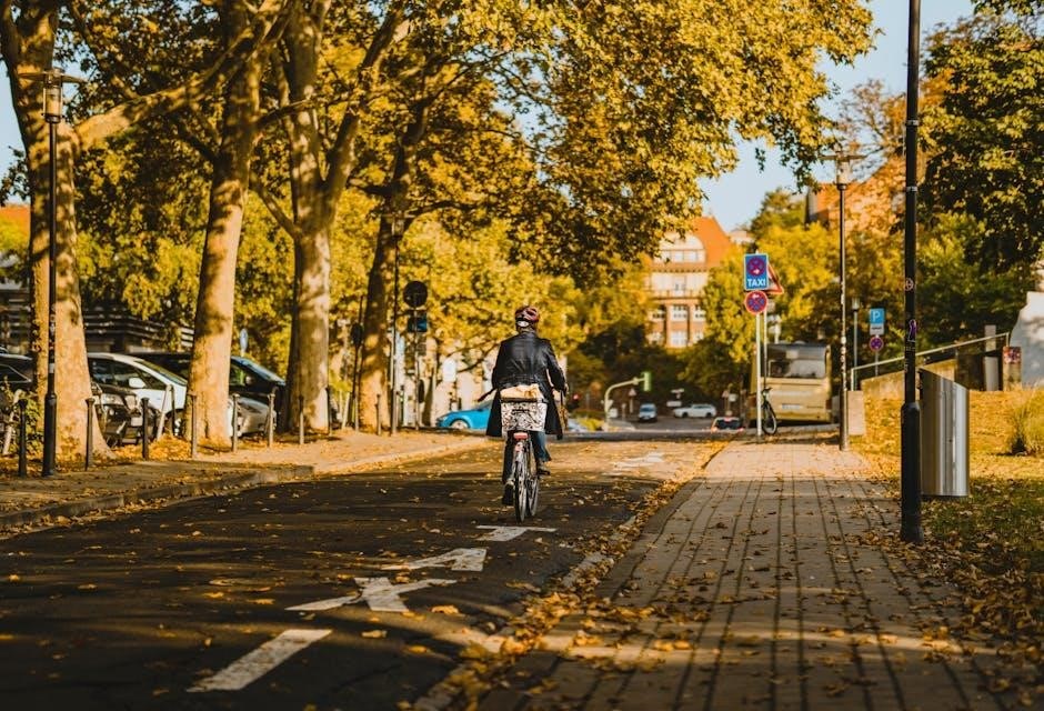
Bicycle Lanes vs. Cycle Tracks
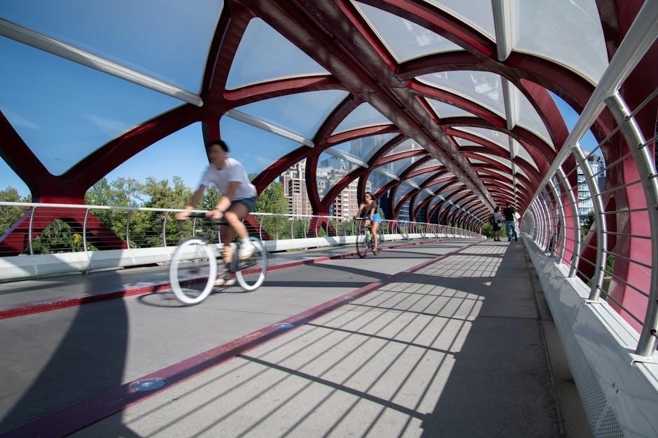
BC’s active transportation design differentiates between bicycle lanes and cycle tracks based on the level of separation from vehicular traffic. Bicycle lanes utilize painted markings to designate space for cyclists within the roadway, offering minimal physical protection.
Cycle tracks, conversely, provide a physically separated pathway for bicycles, often using barriers, curbs, or landscaping. This increased separation significantly enhances cyclist safety and comfort, encouraging greater ridership.
The choice between lanes and tracks depends on factors like road width, traffic volume, and desired level of service. Cycle tracks are generally preferred on higher-speed or high-volume streets, while lanes may suffice on quieter routes.
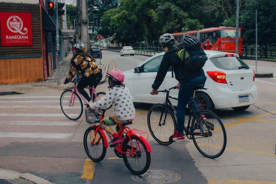
Intersection Design for Bicycles
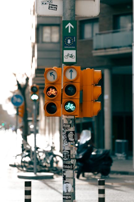
BC’s active transportation design prioritizes bicycle safety at intersections through several key strategies. These include dedicated bicycle signals, allowing cyclists a protected phase separate from vehicular traffic, and advanced stop lines, increasing visibility.
Colored pavement markings, such as green bike boxes, guide cyclists through complex intersections and highlight conflict zones. Careful attention is given to turning radii, minimizing stress on cyclists making left turns.
Furthermore, designs incorporate direct bicycle routes through intersections, avoiding weaving or abrupt changes in direction. Visibility is maximized by minimizing obstructions and ensuring adequate lighting. These measures collectively aim to reduce collisions and enhance the overall cycling experience.
Design Considerations for Pedestrian Facilities
BC’s pedestrian facility designs emphasize accessibility, prioritizing sidewalk width and smooth surfaces for all users, ensuring comfortable and safe passage.
Sidewalk Width and Accessibility
British Columbia’s active transportation guidelines prioritize sidewalk widths accommodating diverse users, including pedestrians, wheelchairs, and strollers. Minimum widths should adhere to provincial standards, often exceeding 1.5 meters to facilitate comfortable passing.
Accessibility is paramount; designs must comply with accessibility regulations, ensuring smooth, even surfaces free from obstructions. Tactile warning surfaces are crucial near hazards like street crossings.
Consideration should be given to pedestrian volumes and adjacent land uses, widening sidewalks in high-traffic areas or near schools. Proper grading and drainage prevent water accumulation, enhancing usability during inclement weather. Regular maintenance is vital to uphold accessibility standards and prevent trip hazards.
Crosswalk Design and Placement
Effective crosswalk design within BC’s active transportation framework prioritizes pedestrian safety and visibility. Placement should occur at logical crossing points, minimizing crossing distances and aligning with desire lines. High-visibility markings, like zebra stripes or continental crosswalks, enhance driver awareness.
Consideration must be given to pedestrian volumes, vehicle speeds, and sightlines. Refuge islands can provide a safe mid-crossing haven on wider roadways. Leading Pedestrian Intervals (LPIs) grant pedestrians a head start, increasing visibility.
Accessibility features, such as tactile paving, aid visually impaired individuals. Regular maintenance ensures markings remain clear and visible, contributing to a safer pedestrian environment.
Pedestrian Signals and Timing
BC’s active transportation design guidelines emphasize pedestrian signal timing that prioritizes safe and efficient crossings. Walk phases must be adequately long to accommodate pedestrians of all abilities, including seniors and those with mobility devices. Minimum walk times should adhere to established engineering standards.
Pedestrian Hybrid Beacons (PHBs) offer a cost-effective solution for unsignalized crossings, activated by pedestrian demand. Accessible Pedestrian Signals (APS) provide audible and tactile cues for visually impaired individuals.
Coordination with vehicle signal phases is crucial to minimize conflicts. Implementing pedestrian countdown timers enhances predictability and reduces risky crossing behaviors, fostering a safer environment for all.
Safety and Security
BC’s guide prioritizes safety through enhanced lighting, traffic calming, and Crime Prevention Through Environmental Design (CPTED) principles.
These measures aim to create secure active transportation networks for all users.
Lighting and Visibility
Adequate lighting is crucial for safety and security on active transportation routes, particularly during nighttime hours and periods of low visibility. The BC Active Transportation Design Guide emphasizes the importance of well-lit pathways and crossings to enhance user comfort and deter crime.
Lighting designs should minimize glare, directing illumination downwards to effectively illuminate the path without disrupting nearby residents or drivers. Consideration should be given to the spacing of light fixtures, ensuring consistent illumination levels along the entire route. Utilizing energy-efficient LED lighting is also recommended for sustainability.
Visibility is further improved through the use of reflective signage, pavement markings, and landscaping that doesn’t obstruct sightlines. Strategic placement of vegetation can enhance the sense of security while maintaining clear visibility for all users.
Traffic Calming Measures
Implementing traffic calming measures is essential for creating safer environments for pedestrians and cyclists, as outlined in the BC Active Transportation Design Guide. These strategies aim to reduce vehicle speeds and volumes on streets shared by vulnerable road users.
Common techniques include speed humps, raised crosswalks, curb extensions (bulb-outs), and chicanes. These physical alterations to the roadway encourage drivers to slow down and exercise greater caution. Roundabouts can also effectively manage traffic flow while reducing collision severity.
Strategic placement of these measures, combined with clear signage and pavement markings, reinforces pedestrian and cyclist priority. Prioritizing designs that accommodate all modes of transportation fosters a more balanced and safer streetscape for everyone.
Crime Prevention Through Environmental Design (CPTED)
Integrating Crime Prevention Through Environmental Design (CPTED) principles into BC’s active transportation projects enhances safety and security for all users. CPTED focuses on influencing offender behavior through thoughtful design.
Key strategies include enhancing natural surveillance by maximizing visibility – trimming vegetation, ensuring adequate lighting, and avoiding blind corners. Territorial reinforcement, achieved through clear definition of public and private spaces, discourages unwanted activity.
Natural access control, like strategically placed landscaping or bollards, guides pedestrian and cyclist flow while limiting vehicle access to sensitive areas. Maintenance plays a crucial role; well-maintained spaces signal ownership and deter crime. A holistic CPTED approach creates a safer, more welcoming environment.
Materials and Construction
BC guides prioritize durable pavement materials, effective drainage systems, and clear signage for active transportation facilities, ensuring longevity and usability.
Pavement Materials
Selecting appropriate pavement materials is crucial for durable and safe active transportation infrastructure in British Columbia. Considerations extend beyond initial cost to encompass lifecycle analysis, including maintenance requirements and environmental impact. Asphalt is commonly used due to its cost-effectiveness and ease of installation, but concrete offers greater longevity and can withstand heavier use.
Permeable pavements are increasingly favored for their ability to reduce stormwater runoff, contributing to sustainable drainage solutions. Material choices should align with the specific application – a shared-use path may require different properties than a dedicated bicycle lane. Furthermore, recycled materials should be prioritized where feasible, supporting BC’s commitment to environmental stewardship. Proper sub-base preparation is essential for all pavement types, ensuring stability and preventing premature failure.
Drainage Considerations
Effective drainage is paramount in British Columbia’s active transportation design, given the province’s varied climate and potential for heavy rainfall. Proper drainage prevents water accumulation, mitigating risks of hydroplaning for cyclists and slippery surfaces for pedestrians. Designs must account for surface runoff, directing water away from the pathway and preventing erosion of surrounding landscapes.
Implementing cross-slopes, ditches, and strategically placed catch basins are essential techniques. Permeable pavements, as previously mentioned, offer a sustainable solution by allowing water to infiltrate directly into the ground. Consideration should be given to potential impacts on adjacent properties and ecosystems, ensuring drainage systems do not exacerbate flooding or negatively affect water quality. Regular inspection and maintenance of drainage infrastructure are vital for long-term functionality.
Signage and Wayfinding
Clear and consistent signage is crucial for successful active transportation networks in British Columbia. Wayfinding systems should guide users efficiently, indicating distances to key destinations, route numbers, and potential hazards. Signage must adhere to provincial standards for visibility, reflectivity, and legibility, ensuring comprehension for all users, including those with visual impairments.
Employing a hierarchy of signs – from major route markers to directional indicators – enhances navigation. Consider incorporating maps at key intersections and decision points. Signage should be multilingual in areas with diverse populations. Furthermore, integrating active transportation routes into broader regional wayfinding strategies promotes connectivity and encourages greater utilization of these sustainable transportation options. Consistent branding builds user confidence.

Maintenance and Operations
Regular inspections, prompt snow/ice removal, and diligent vegetation management are vital for maintaining safe and functional active transportation infrastructure in BC.
Regular Inspections
Consistent and scheduled inspections are paramount to ensuring the longevity and safety of BC’s active transportation networks. These inspections should encompass a comprehensive review of all infrastructure components, including pavement surfaces for cracking or deterioration, signage for visibility and accuracy, and lighting systems to confirm optimal functionality.
Detailed records of each inspection, documenting identified deficiencies and subsequent repair actions, are crucial for tracking maintenance needs and prioritizing resources. Inspections should also assess drainage systems to prevent water accumulation and potential hazards. Furthermore, a focus on accessibility features, like curb ramps, is essential to maintain inclusivity. Proactive identification and resolution of issues minimize costly repairs and enhance user experience.
Snow and Ice Removal
Effective snow and ice removal is critical for maintaining safe active transportation routes throughout BC’s winter months. Prioritization should focus on high-use corridors, pedestrian crossings, and areas near schools and healthcare facilities. Strategies include plowing, sanding, and de-icing, employing environmentally responsible materials whenever possible.
Regular clearing prevents hazardous conditions, ensuring accessibility for all users, including those with mobility challenges. Designated snow storage locations should avoid obstructing pathways or visibility. Communication regarding snow removal schedules and route closures is vital. Furthermore, consideration should be given to the impact of snowbanks on sightlines and pedestrian flow, proactively mitigating potential risks. Consistent maintenance enhances winter usability.
Vegetation Management
Proactive vegetation management is essential for maintaining clear sightlines, pathway widths, and overall safety along BC’s active transportation networks. Regular pruning of trees and shrubs prevents obstructions and ensures adequate illumination, particularly during shorter daylight hours. Invasive species control is also crucial to preserve pathway integrity and biodiversity.
Consideration should be given to seasonal growth patterns and potential hazards like falling branches. Avoid planting species with aggressive root systems near paved surfaces. Utilize native plants where feasible to minimize maintenance and support local ecosystems. A well-maintained landscape enhances user experience and contributes to a welcoming environment for pedestrians and cyclists alike, promoting consistent use.